|
|

Categorical Day2 0700Z Outlook
|
|
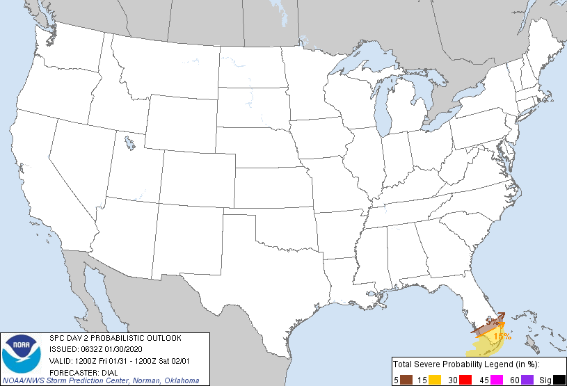
Probability of severe weather within 25 miles of a point.
Hatched Area: 10% or greater probability of significant severe weather within 25 miles of a point.
|
|
|
Images courtesy of the NWS Storm Prediction Center
000
ACUS02 KWNS 070602
SWODY2
SPC AC 070600

Day 2 Convective Outlook
NWS Storm Prediction Center Norman OK
0100 AM CDT Tue May 07 2024

Valid 081200Z - 091200Z

...THERE IS AN ENHANCED RISK OF SEVERE THUNDERSTORMS FROM NORTHEAST
TEXAS INTO THE MID-SOUTH/MID MISSISSIPPI VALLEY AND LOWER OHIO
VALLEY...

...SUMMARY...
Scattered to numerous severe thunderstorms appear likely Wednesday
across from parts of the southern Plains into the mid Mississippi,
Ohio, and Tennessee Valleys. All severe hazards, including
tornadoes, very large hail, and severe/damaging winds should occur.
Some of the tornadoes may be strong.

...Synopsis...
An upper cyclone initially over the northern Plains on Wednesday
should gradually move towards the Upper Midwest through the period.
A separate shortwave trough over the Great Lakes is forecast to
advance eastward across NY and New England. A broad 50-70 kt
mid-level west-southwesterly jet should remain over the
southern/central Plains into the mid MS Valley, OH Valley/Midwest,
and Northeast. This jet will aid in rather strong deep-layer shear
across much of these regions.

At the surface, a weak low over OK should develop northeastward to
the mid MS Valley by Wednesday afternoon in tandem with a lobe of
mid-level vorticity/ascent also spreading northeastward over this
region. An attendant cold front should move east-southeastward
across the southern/central Plains, with a dryline extending
southward from central into south TX. A warm front should attempt to
lift northward through the day across MO and southern IL/IN/OH. But,
how far north the warm front will be able to lift northward remains
rather uncertain. All of these boundaries should provide a focus for
potential severe thunderstorm development Wednesday afternoon and
evening.

...ArkLaTex into the Mid Mississippi Valley and Ohio Valley...
A large area of significant severe potential remains evident across
these regions on Wednesday. Across the broad warm sector, upper 60s
to mid 70s surface dewpoints should generally prevail. Even modest
daytime heating of this very moist low-level air, acting in concert
with steepened mid-level lapse rates spreading eastward from the
southern/central Plains, will foster around 2500-3500 J/kg of MLCAPE
by Wednesday afternoon. Some locally higher/more extreme instability
values will be possible. With enhanced flow associated with the
previously mentioned mid-level jet, effective bulk shear of 40-50+
kt will easily support organized severe thunderstorms, including the
potential for numerous supercells and intense bowing line segments.

Based on latest guidance trends showing the warm front stalling/not
making as much northward progress into the OH Valley, the northern
extent of the higher severe probabilities has been trimmed some
across this area. Otherwise, very large hail appears probable with
initial development along the cold front and warm front, which may
begin across MO as early as mid Wednesday morning. Additional
supercell development may also occur along/near the warm front by
early Wednesday afternoon across parts of the mid MS Valley into the
lower OH Valley. In addition to the large/very large hail threat, a
concern for tornadoes also exists with this warm-frontal activity
given ample 0-1 km shear to support low-level updraft rotation. Some
of these tornadoes could be strong given the forecast strength of
the low-level shear. An increasing threat for severe/damaging winds
is also apparent through the late afternoon, and likely continuing
into at least the early evening, as convection should attempt to
grow upscale into one or more intense bowing clusters. With that
said, convective evolution is somewhat uncertain, and attempting to
pinpoint areas of greater severe-wind potential remains difficult.

...Iowa and Vicinity...
Isolated strong to severe thunderstorms appear possible in
associated with a cold-core upper low across parts of IA and
vicinity, mainly Wednesday afternoon. Although forecast instability
and deep-layer shear appear fairly weak/marginal, a few instances of
hail and strong/gusty winds appear possible. A brief tornado or two
may also occur along/near the occluded front.

...Southern New England into NY and the Mid-Atlantic/Carolinas...
Occasional hail and strong to locally damaging winds appear possible
with isolated thunderstorms across parts of NY into southern New
England as a surface low and attendant cold front move eastward
through the day. Farther south into the Mid-Atlantic/Carolinas,
greater instability is forecast. But, better forcing should
generally remain displaced to the west. It remains unclear how many
thunderstorms will form. Still, any that do could become strong to
locally severe.

..Gleason.. 05/07/2024

$$