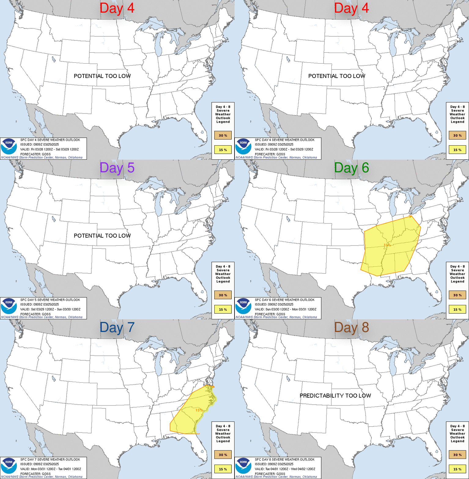
| Day 4-8 Severe Weather Outlook. A depicted severe weather area indicates a 30% or higher probability for severe thunderstorms within 25 miles of a point. |
| D4 | Tue, May 21, 2024 - Wed, May 22, 2024 |
D7 | Fri, May 24, 2024 - Sat, May 25, 2024 |
| D5 | Wed, May 22, 2024 - Thu, May 23, 2024 |
D8 | Sat, May 25, 2024 - Sun, May 26, 2024 |
| D6 | Thu, May 23, 2024 - Fri, May 24, 2024 |
(All days are valid from 12 UTC - 12 UTC) |
PREDICTABILITY TOO LOW is used to indicate severe storms may be possible based on some model scenarios. However, the location or occurrence of severe storms are in doubt due to:
- 1) large differences in the deterministic model solutions,
- 2) large spread in the ensemble guidance, and/or
- 3) minimal run-to-run continuity.
|
| POTENTIAL TOO LOW means the threat for a regional area of
organized severe storms appears highly unlikely during the entire
period (e.g. less than a 30% probability for a regional severe
storm area across the CONUS through the entire Day 4-8 period). |
Images courtesy of the NWS Storm Prediction Center
000
ACUS48 KWNS 180900
SWOD48
SPC AC 180858

Day 4-8 Convective Outlook
NWS Storm Prediction Center Norman OK
0358 AM CDT Sat May 18 2024

Valid 211200Z - 261200Z

...DISCUSSION...
...Day 4/Tue -- Southern Plains to the Mid/Upper MS Valley...

Medium-range guidance has been fairly consistent the past several
cycles in showing a negatively tilted upper shortwave trough
ejecting across the central Plains to the upper Great Lakes on
Tuesday. As this occurs, a surface cyclone over NE/KS will deepen
and track northeast to MN/WI by 06z. As this occurs, a surface cold
front will develop east across the region, becoming oriented from
near Lake Michigan southwestward to northwest TX by Wednesday
morning. Across the warm sector, mid/upper 60s F dewpoints will be
widespread, aiding in moderate to strong destabilization during the
day. Storms will likely develop by early afternoon near the surface
low and cold front across western IA southward into eastern KS. The
current expectation is that a linear MCS will evolve over IA/MO and
shift east through the evening. While damaging gusts will be the
primary hazard, large hail and tornadoes also will be possible.

With southward extent into OK and portions of the Ozarks, convective
coverage may be less. This area will be further removed from
stronger large-scale ascent, and capping may erode less efficiently
as a result. Nevertheless, where storms can develop, supercell wind
profiles amid a very moist and unstable airmass will support an
all-hazards risk.

...Day 5/Wed -- ArkLaTex to the Ohio Valley...

Forecast guidance differs quite a bit on Wednesday with regards to
the evolving the upper trough/low over the Great Lakes. The surface
cold front will likely continue eastward into parts of the Ohio
Valley. A moist airmass will be in place, but degree of downstream
destabilization ahead of likely ongoing convection Wednesday morning
is uncertain.

The front will likely stall across the Mid-South into the southern
Plains as upper support moves well north of the region. This could
focus severe-thunderstorm potential during the afternoon along the
stalled boundary. However, capping may be a concern given weak
forcing aloft and a generally low-amplitude upper pattern over the
region.

While some severe potential will exist across this broad region,
confidence is too low to include a 15 percent area at this time.

...Days 6-8/Thu-Sat...

Most guidance maintains a mean upper trough over the western U.S.
late in the period. An upper shortwave trough is forecast to eject
eastward across the southern Plains to the Lower MS Valley Day
6/Thu. A very moist and unstable airmass will already be in place as
favorable vertical shear and large-scale ascent overspread the
region, likely resulting in severe-thunderstorm potential across
parts of OK into the ArkLaTex.

By Day 7/Fri, spread among forecast guidance increases considerably
and predictability is low.

..Leitman.. 05/18/2024


