|
|

Categorical Day2 0700Z Outlook
|
|
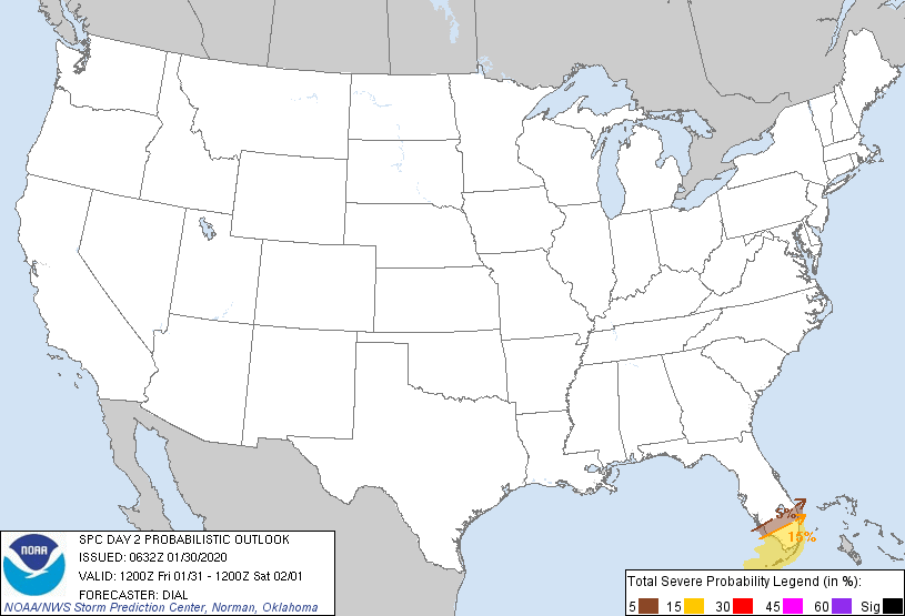
Probability of severe weather within 25 miles of a point.
Hatched Area: 10% or greater probability of significant severe weather within 25 miles of a point.
|
|
|
Images courtesy of the NWS Storm Prediction Center
000
ACUS02 KWNS 180552
SWODY2
SPC AC 180550

Day 2 Convective Outlook
NWS Storm Prediction Center Norman OK
1250 AM CDT Sat May 18 2024

Valid 191200Z - 201200Z

...THERE IS AN ENHANCED RISK OF SEVERE THUNDERSTORMS ACROSS PORTIONS
OF WESTERN AND CENTRAL KANSAS...

...SUMMARY...
Severe thunderstorms are most likely across parts of Kansas Sunday
afternoon and evening. Significant damaging gusts, large to very
large hail, and a few tornadoes all appear possible.

...NE/KS/OK...

A weak upper shortwave impulse over NE Sunday morning will quickly
lift northeast. Some convection may be ongoing across NE/KS during
the morning, but is forecast to quickly weaken/shift east. This
early activity may suppress severe potential across northeast NE
during the afternoon as airmass recovery is uncertain. By afternoon,
another upper shortwave trough is forecast to eject from the
southern/central Rockies into KS, and then the Lower MO Valley by
Monday morning. This secondary shortwave trough will be the focus
for the primary severe risk during the afternoon/evening.

A surface dryline is forecast to extend southward from near the
NE/KS/CO border into western KS and then near the OK/TX border. To
the east of the dryline, dewpoints into the low/mid 60s are expected
across OK into central/eastern KS (somewhat lower across northern KS
and southern NE). Very steep midlevel lapse rates (greater than 8
C/km) will be in place. Capping will suppress convection until
mid/late afternoon, when large-scale ascent increases amid strong
heating and continued warm/moist advection. High-based storms along
the dryline will initially pose a risk of large hail and damaging
gusts. Forecast guidance (including HREF and CAMs) show a strong
signal for upscale growth into an intense bow is possible across KS.
Upscale growth is possible via consolidating outflow and an
increasing low-level jet during the late afternoon/early evening.
Significant gusts will be possible if this scenario evolves as
expected. Large to very hail and a few tornadoes also will be
possible. Hail greater than 2 inches in diameter will be possible
early in convective evolution, but eastward extent of this risk is
uncertain and dependent on storm mode.

Severe potential southward along the dryline into western OK is more
uncertain and conditional. If a storm can develop and be maintained,
all severe hazards would be possible, particularly very large hail
and damaging gusts.

...SD vicinity...

Southerly low-level flow will transport mid/upper 50s F dewpoints
northward into northern NE/SD and southern ND. A cold front is
forecast to develop eastward during the late Sunday afternoon into
Sunday night. Steep midlevel lapse rates will be in place, but an
EML will likely limit a greater severe risk. Nevertheless, MUCAPE to
around 1500 J/kg will support elevated convection ahead of the cold
front. Isolated hail will be the main risk. However, if an organized
line of storms can develop, some gusty winds also are possible.

...Lower MO Valley toward the Mid-MS Valley...

Convection from NE/KS may dissipate over the area during the
morning. However, a warm front is expected to slowly lift northward
through the day, allowing from some airmass recovery and
destabilization. Convection may redevelop near this boundary during
the afternoon. This activity may produce marginally severe hail and
gusty winds.

...FL...

An upper trough from the Mid-Atlantic to the northern Gulf will
shift east over the Atlantic on Sunday. A belt of enhanced
west/southwesterly flow (30-40 kt at 700 mb) will overspread the FL
peninsula ahead of the trough. Mid to upper 60s F surface dewpoints
and strong heating will contribute to MLCAPE values around 1500-2500
J/kg. Steep low-level lapse rates will support isolated strong gusts
in water-loaded downdrafts. Elongated/straight forecast hodographs
and modest midlevel lapse rates (6.5-7 C/km) suggest isolated large
hail also is possible. Effective shear around 30 kt suggests
organized updrafts may be somewhat transient. If confidence
increases regarding coverage of organized severe convection, higher
probabilities may be needed in subsequent outlooks.

..Leitman.. 05/18/2024

$$